
Powerhouse storm to rock Northeast, snarl holiday travel a week before Christmas


A major storm will rock around Christmas trees and blast other outdoor holiday decorations while some communities are expected to experience dangerous conditions with high winds and flooding from the mid-Atlantic to New England through Monday.
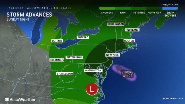
Those planning on traveling through the start of next week will want to pay attention to AccuWeather forecast details, as the upcoming weather may make or break the trip on particular days and locations. Conditions will deteriorate quickly from south to north on Sunday and Sunday night.
 |
Slow travel is likely due to flooded roads, airline delays and flight cancellations. Regional power outages are possible from the upcoming storm on the Eastern Seaboard that is already gathering strength in the Gulf of Mexico.
This system will have the look and feel of a tropical storm as it races quickly northward from Sunday to Monday, AccuWeather Chief On-Air Meteorologist Bernie Rayno said.
Weather enthusiasts along the East Coast with home weather stations equipped with barometers will be able to watch the atmospheric pressure fall quickly -- an indication of the vigor behind the coastal storm.
 |
If the storm does not reach the official criteria of a bomb cyclone as it strengthens rapidly into Monday, it may not miss it by much. In order to be dubbed a bomb cyclone, the central barometric pressure within a storm must fall 0.71 of an inch of mercury (24 millibars) in 24 hours or less.
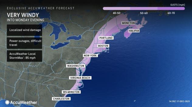
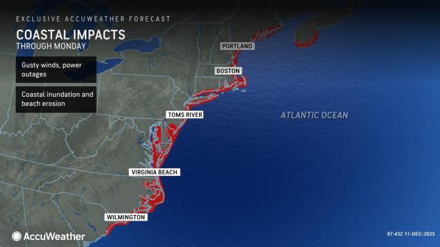
"There is the likelihood of damage along the mid-Atlantic and New England coasts from this storm as it intensifies rapidly and produces a zone of strong winds that pushes water from the Atlantic toward the shoreline, while at the same time, heavy rain pours down," Rayno explained. "Wind gusts will range between 40 and 60 mph and could easily approach 70 mph along the coast." Gusts of 74 mph or greater are considered hurricane-force winds. The AccuWeather Local StormMax™ wind gust is 85 mph for this event.
 |
Storm drains will be overwhelmed by the rate of rain, which can fall at the rate of 0.50 of an inch per hour or greater, resulting in a heightened risk of street and highway flooding.
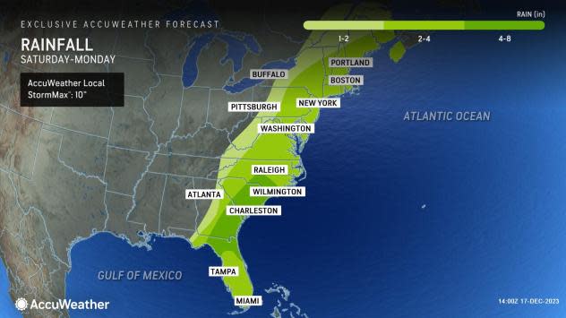
A broad zone where 1-4 inches of rain will pour down from the storm will extend from North Carolina to Maine, with local amounts of up to 5 inches possible. In the Southeast states, where the storm will have direct access to tropical moisture, the AccuWeather Local StormMax™ rainfall is 10 inches.
 |
The combination of heavy rain and a surge of water from the Atlantic will lead to moderate flooding in coastal beach communities with back bay and tidal river flooding from the Carolinas to Maine. Conditions will be worse during high tide, but stiff east-southeast winds may prevent much water from escaping on the front side of the storm. This means that some homes and neighborhoods could be cut off for hours.
 |
Beach erosion will occur, and some damage to dunes and other beach structures is possible.
The worst conditions due to rain, flooding and powerful winds will occur in the zone from Virginia to New York during Sunday afternoon and Sunday night and in New England from Sunday night to Monday midday.
Farther inland, in the mountain and valley zone of the Appalachians, windswept rain is in store, and fog will shroud the ridges.
Quick rises and flooding are likely to occur on small streams from Sunday night to Monday. Some of the rivers from Pennsylvania, New Jersey and New York state to New England may experience minor to moderate flooding as well from Monday to Tuesday as runoff slowly advances.
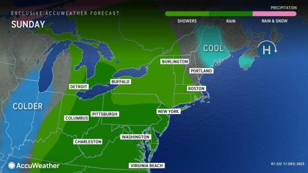
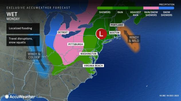
On the backside of the storm, winds will shift quickly to the west and northwest on Monday. The heaviest rain will taper off along the coast from south to north, but areas of rain will linger as the air turns colder over the Appalachians.
 |
Due to the raging storm, the Monday morning commute in Boston and New York City may be slow and difficult. Farther to the southwest in the zone from Philadelphia to Washington, D.C., conditions will improve, but some roads may still be blocked by high water or debris.
The wind shift on Monday may lead to additional power outages as trees sway in the saturated soil and large waterlogged tree limbs break.
While very little to no snow will fall from the storm on its front side, except for perhaps in northern New England, a quick blast of cold air that follows on the storm's backside will bring flurries, dangerous snow squalls and shifting bands of lake-effect snow from the Upper Midwest to the Appalachians from Monday to Tuesday. It is possible that snow showers reach as far south and east as the Interstate 95 mid-Atlantic zone late Monday night and Tuesday.
Want next-level safety, ad-free? Unlock advanced, hyperlocal severe weather alerts when you subscribe to Premium+ on the AccuWeather app. AccuWeather Alerts™ are prompted by our expert meteorologists who monitor and analyze dangerous weather risks 24/7 to keep you and your family safer.
