
UK weather: Torrential rain warnings issued for weekend as Met Office gives update on snow
A pre-festive dusting of snow could fall in parts of the UK this week as a cold snap sees temperatures plunging and a fresh weather warning.
Frosty weather is expected in the northeast of Scotland as showers are set to hammer down across large swathes of the UK.
Met Office meteorologist Aidan McGivern said: “For the start of Saturday, we keep the cold conditions at first across parts of central and eastern Scotland, so there will be a touch of frost in the northeast of Scotland and some snowflakes over the hills and mountains, as the rain bumps into that cold air.”
It comes as a yellow weather warning for rain has been issued for parts of southern England and Wales on Friday and Saturday.
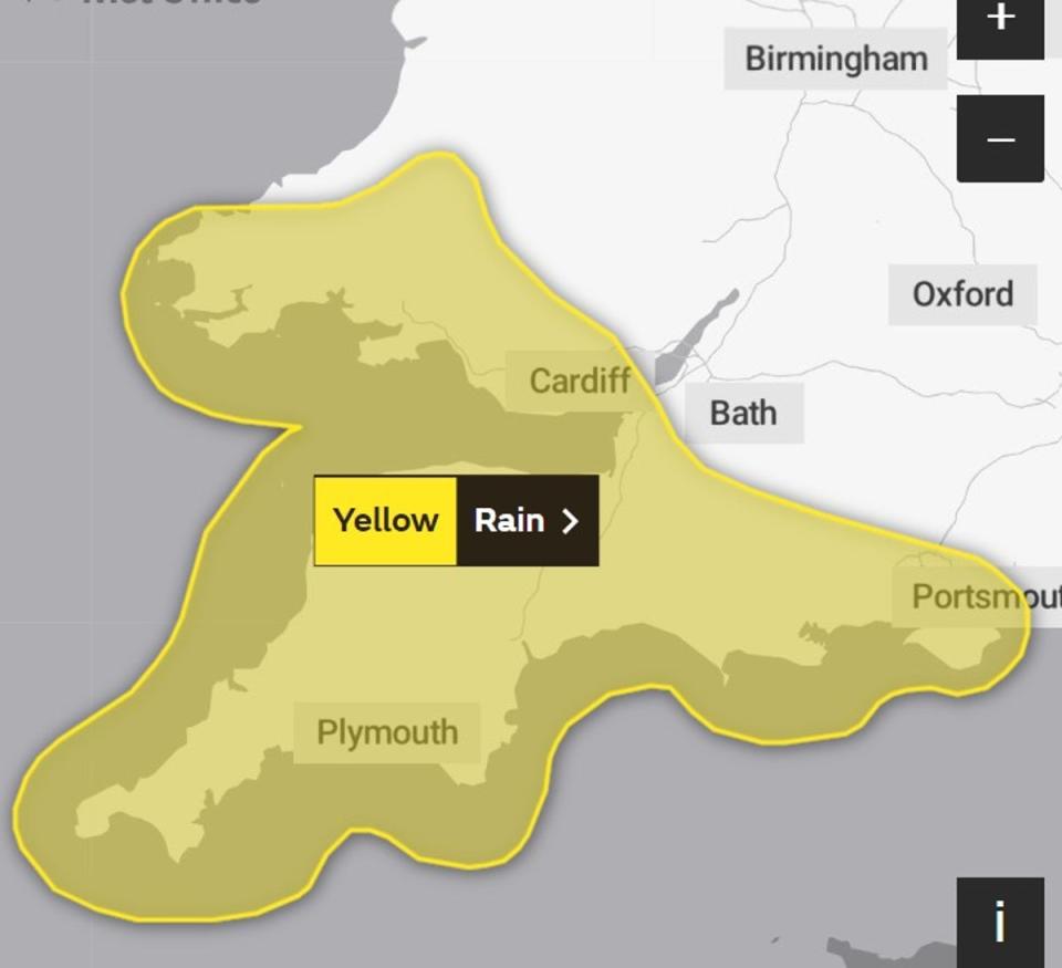
The warning, which is in place from 9pm on Friday to 3pm on Saturday, is “likely to be heavy at times, and follows many weeks of above-average rainfall in this area,” the Met Office said.
The downpours could result in up to 50mm of rain on hills in some areas as well as localised flooding.
⚠️ Yellow weather warning issued ⚠️
Heavy rain across southern parts of Wales and southwest England
Friday 2100 – Saturday 1500
Latest info 👉 https://t.co/QwDLMfRBfs
Stay #WeatherAware⚠️ pic.twitter.com/UJJ5QsHIu2— Met Office (@metoffice) November 16, 2023
The fresh weather alert comes after Storm Debi left the UK reeling as it unleashed widespread flooding and devastating winds across many parts of the country this week, particularly in Northern Ireland.
Severe gales caused power cuts across the island of Ireland, with around 100,000 homes and businesses left without electricity.
Gusts of 77mph were recorded in Gwynedd, 74mph at Killowen in Northern Ireland and 68mph on the Isle of Man as the low pressure system moved across the Irish Sea.

UK 5-day forecast
Thursday night:
Rain will spread eastwards across the UK this evening with a few showers developing behind this in the west. Clear spells developing too with frost and fog developing for some.
Friday:
A chilly but largely dry and bright start though with a few showers in the west. Sunshine turning hazy in the southwest into the afternoon with rain moving through later.
Outlook for Saturday to Monday:
Turning wet and windy through Saturday with rain spreading northeastwards and showers following behind. Sunny spells returning on Sunday with the risk of blustery showers which will continue into Monday.

