
UK weather: Schools closed and train services cancelled amid flooding as heavy downpours hit large parts of country
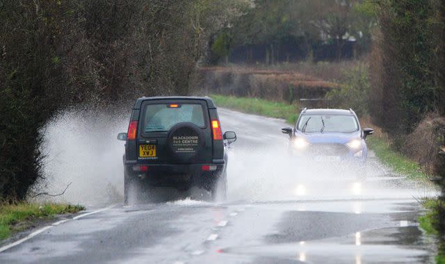
Schools have been closed and travel disrupted after roads and railway lines were flooded by heavy rain falling on already saturated ground across large parts of the UK.
A yellow warning for rain was issued by the Met Office for today covering much of southern, central and eastern England.
Most places within the affected area would have 10-15mm of rainfall, but a few places could see 30-40mm, said the weather agency.
A yellow warning for wind was also in place today for London and southern England, where gusts could reach 60mph to 70mph.
There was a "small chance of injuries and danger to life from flying debris", said the Met Office, while the strong winds could lead to the closure of some bridges and roads.
The warnings were both due to last until 6pm today.
There have also been other yellow warnings issued recently for rain covering most of southern, southwestern, central and eastern England as well as parts of South Wales.
Find out the weather forecast where you live
As of 4pm on Thursday, the Environment Agency had issued 72 flood warnings for England, meaning flooding was expected, and 254 alerts, meaning floods were possible. National Resources Wales had issued one flood warning and 23 alerts.
In Herefordshire and Worcestershire, several schools have closed because of rising flood levels and "treacherous road conditions", councils said.
Many roads across the West Midlands have been submerged and rail operators have been working to resolve issues on the tracks.
Transport for Wales and West Midlands Railway services are operating a replacement bus service between Shrewsbury and Wolverhampton.
And CrossCountry services between Birmingham New Street and Cheltenham Spa have reopened after earlier flooding, though trains may still be cancelled or delayed. The route between Worcester Foregate St and Hereford has also been affected.
Flooding has also caused disruption to rail services in Devon and Cornwall, Great Western Railway said.
Met Office spokesman Grahame Madge said: "The current forecast contains a typical mix of winter weather, including strong winds and heavy rain.
"In themselves these conditions aren't exceptional, but following on from significant amounts of rainfall across February, then the cumulative effect means that river catchments are more sensitive to additional rainfall.
"During these warning periods, we urge people to follow sensible advice and keep up to date with the warnings and the forecast."
The unsettled and mild conditions will eventually clear in the coming days, making way for colder weather as temperatures return to more usual levels for this time of year.
Read more on Sky News:
Man tells how he rescued driver from 4ft-high water
Flood risk increased as new housing built without defences
Sky News weather producer, Christopher England, said: "It'll stay unsettled for the next few days, with widespread showers and some more general heavy rain and strong winds in the South on Thursday.
"The wind will become more northerly as the rain clears, so it'll be colder than recently, with temperatures nearer the February average. Expect some snow on northern hills.
"Saturday and Sunday look drier for many northern and central parts, although there'll still be some showers in the North and West, while the South will turn wet and windy again overnight into Sunday, with coastal gales developing.
"It'll stay chilly for most, after extensive overnight frosts, but it'll turn quite mild in the South again.
"Monday will be similar, with rain and strong winds in the South only slowly clearing."

