UK weather: Maps reveal where rain will hit as February poised to be wettest in 258 years
Some more showers are set to lash parts of the UK this week after what is set to be the wettest February in 258 years.
Wednesday will have a dry start for most, the Met Office forecast says, but rain is expected to move in from the West expanding eastwards, and covering all parts as the day progresses.
The showers will continue intermittently throughout the week, occasionally blustery with some sunny spells.
”Whilst there will be some heavy rain at times this week, it’s not going to be as wet as it has been through much of February,” said Alex Burkill, meteorologist at the Met Office.
Overall, 129mm of rain – two-and-a-half times the 48mm average – will have drenched Britain by the end of the month, Met Office’s preliminary figures show, making it the wettest February in over two and a half centuries.
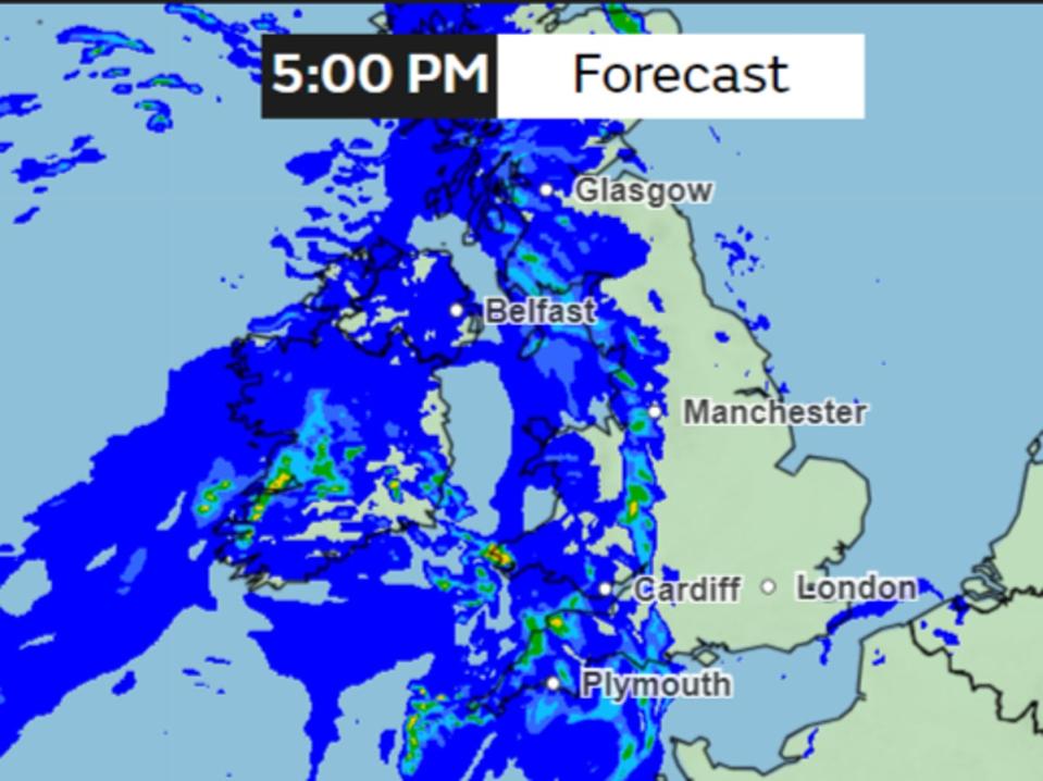
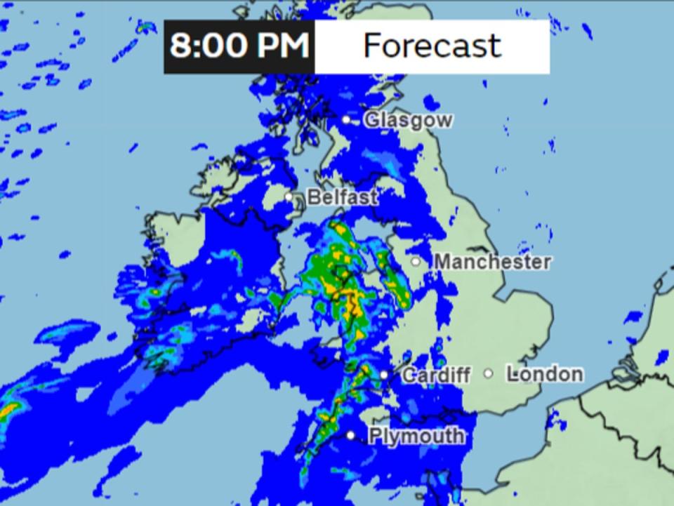
Here are some maps showing the rainfall forecast on Wednesday.
A band of rain can be seen moving into the UK from the west covering Northern Ireland and parts of Scotland and the southwest by the afternoon.

This band of rain will continue to move through the country eastwards, covering the Midlands and parts of Southwest England as the day progresses.
The rain will be heaviest over the western hills, the Met Office warned, with the forecast showing some regions receiving up to 4mm per hour of rainfall.

Some areas in the Southwest England, Midlands and far north of Scotland can receive heavy rainfall.
There are about 117 alerts for potential flooding and 40 warnings still in place, but most have been removed. The Met Office has warned some regions can still be prone to flooding as the rain falls on already saturated grounds.

By evening, the rainfall is expected to intensify in Wales, with the amount falling in northwest Wales including Snowdonia. Some regions can see upto 8mm per hour rainfall.

Overnight on Wednesday, the band of rain will be covering almost the entire country, with 0.5-2mm per hour expected to fall largely while some areas can see occasional heavy rain.

Temperatures are expected to remain in the single digits throughout the country, around the average for this time of the year.
“We’ve had this chilly air over the weekend and to start the week, which is why it’s been a bit colder than it has been recently. But temperatures are only around average for the time of year,” Mr Burkill said.
But there will be a slight increase in mercury in the next couple of days with a low-pressure system bringing warm air in, Mr Burkill said on Tuesday.
“The jet stream is going to change its position as we go through the next couple of days running across the UK and then pushing a little bit towards the Northeast, allowing for some milder, warmer air to make its way across,” he said.
“So that’s why temperatures are going to rise as we go towards the middle part of the week.”
But mercury will again drop on Friday as air from the Arctic comes in once again, the Met Office said.


