Snow and ice hit parts of UK as cold snap continues

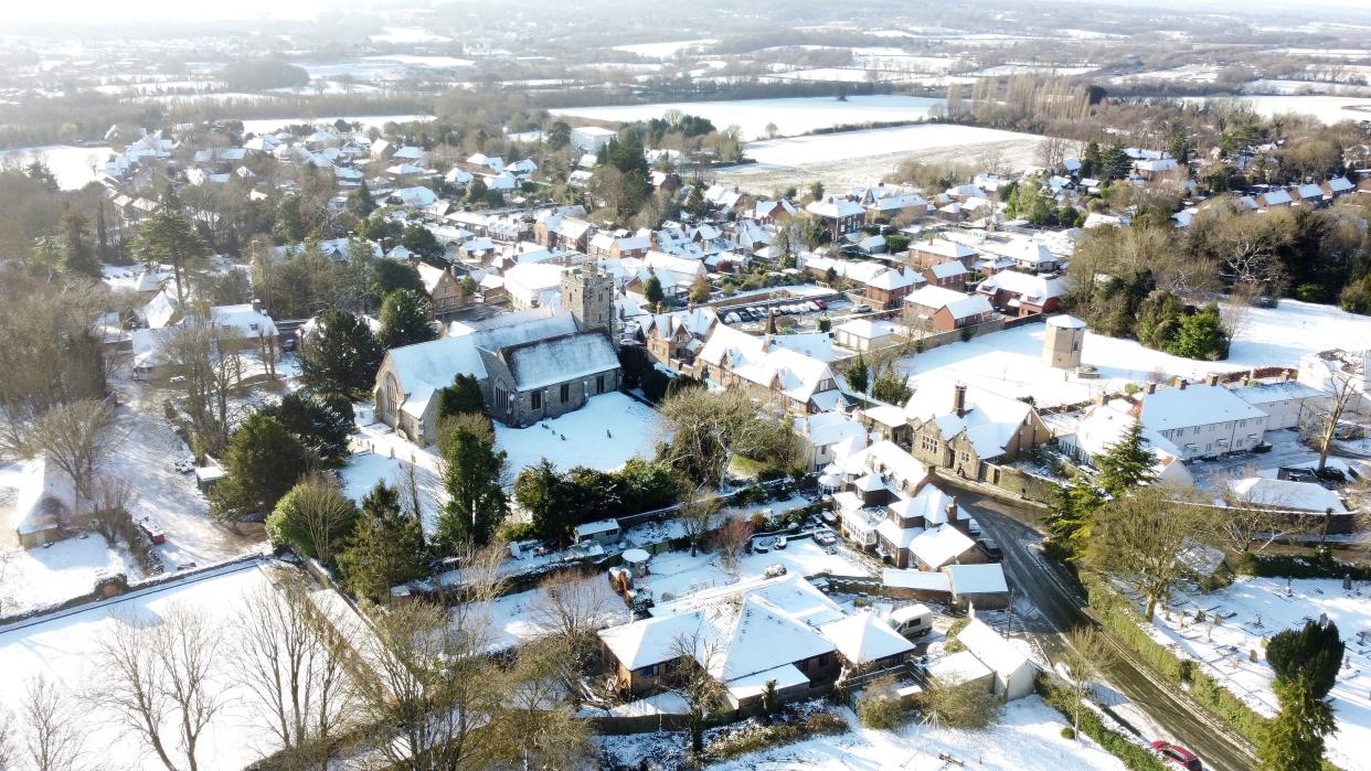
Snow and ice are causing travel disruption for some parts of the UK, with the cold and wintry spell set to continue.
Temperatures, which are around 5C-6C lower than usual for this time of year, will plummet well below freezing overnight, the Met Office said.
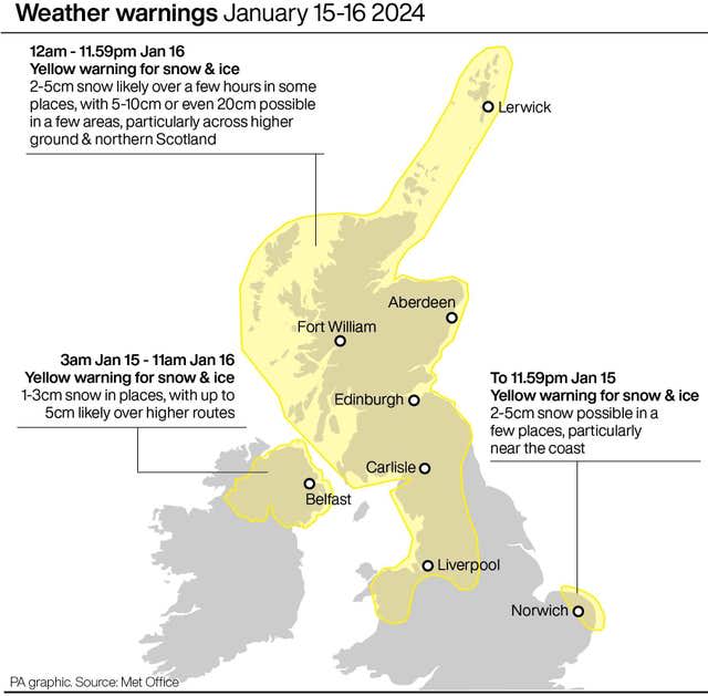
The forecaster has issued yellow warnings for snow and ice covering much of the country.
The RAC said it expected Monday to be its busiest day of the winter so far for vehicle breakdowns.
Snow has already fallen in places such as Ballymena in Northern Ireland and Aberdeen in north-east Scotland.
Strong winds could result in drifting of lying snow in places, the forecaster warned.
The UK Health Security Agency has a Cold-Health Alert in force, which warns of possible impacts for the health and social care sector.
As of midday Sunday 14 Jan, an amber Cold-Health Alert is now in place for the whole of England until midday Friday 19 Jan. Stay up to date with the latest weather alerts from @metoffice and look out for those who may be more vulnerable in the cold. https://t.co/W2FmqSrr56 pic.twitter.com/CazH9aBAsQ
— UK Health Security Agency (@UKHSA) January 15, 2024
Snow and ice warnings are in place until 9am on Tuesday across Northern Ireland.
The Met Office has also issued a warning for “potentially disruptive” snow and ice in parts of East Anglia, including Norwich, which runs until midnight on Monday.
In Scotland, a similar warning is in place in northern areas until midnight.
What are the prospects of seeing any snow where you live this week? ☃️
Here's a look at the current forecast for the week ahead 👇 pic.twitter.com/F3yusbxDTa
— Met Office (@metoffice) January 14, 2024
The chance of snow will remain high across the UK towards the middle of the week, with cold air firmly in place over the UK, the Met Office said.
The area affected by the warning will spread to include the whole of Scotland and into northern England on Tuesday.
National Highways has issued a severe weather alert for snow affecting the North West on Tuesday, with road users advised to plan ahead, and some rural communities warned they could be temporarily cut off.
With snow and ice expected in parts of the country over the next few days, be prepared so your travel plans go without a hitch. ❄️ 🌨️
For more on #TRIP during wintry conditions, visit:
▶️ https://t.co/Av9UdhpRKW pic.twitter.com/YI3hoHpQyx
— National Highways (@NationalHways) January 15, 2024
Amy Fellows, national network manager at National Highways, said: “Freezing conditions bring so many hazards such as snow and ice, so take every possible step to understand your journey in advance and allow lots of extra time when travelling to prepare for the unexpected.”
National Rail has warned the wintry weather could affect train journeys all week.
A further snow warning will be in place on Wednesday across Northern Ireland, northern and western Scotland, much of northern England and north Wales.

Met Office spokesman Grahame Madge said on Monday: “We’re seeing snow across northern parts today. It’s mostly showers at the moment rather than a band, so the levels are sporadic.
“The north of Scotland, including places like Aberdeenshire, will be most affected.
“Temperatures will drop below freezing overnight – as cold as minus 5C or more in some rural areas.
🥶 Get the big coat on because the new week starts with a widespread frost
🌨️ Snow showers pushing into northern Scotland and Northern Ireland bring the risk of icy stretches
☀️ Dry for many inland areas with wall-to-wall winter sunshine pic.twitter.com/SjiPrDDm8P
— Met Office (@metoffice) January 14, 2024
“Temperatures might not get above freezing during the daytime in northern locations like Newcastle.
“In areas further south, like Bristol and Plymouth, temperatures will reach about 4C or 5C but it will feel colder because of the wind chill.
“We’re expecting to see this pattern for the rest of the week.
“Snow is unpredictable, so it’s worth keeping an eye on forecasts.”
A new week of weather is upon us ❄️☁️🌬️🌡️
Check out Monday's #4cast to prepare yourselves for what is to come ⤵️ pic.twitter.com/vfpaMGSYLK
— Met Office (@metoffice) January 14, 2024
Met Office deputy chief meteorologist Chris Bulmer said: “There are a couple of weather systems for Tuesday and Wednesday which we are keeping an eye on that bring the potential for disruptive snow for some regions.
“With cold air firmly in place, any weather systems that move across the country next week will bring mainly snowfall inland.
“Models are currently showing us a variety of options for both systems and we’ll be able to add more details in the coming days.”


