
Severe weather threats to evolve heading into the dog days of summer

This spring was the most active severe weather season since 2011 with more than 1,000 twisters reported across the country. However, a change is on the horizon that will transform the severe weather dangers heading into the dog days of summer.
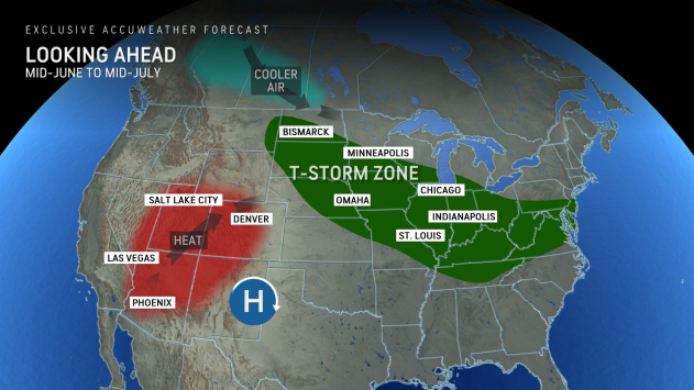
"[We're] going to see disturbances coming down from the northern Rockies and through the northern Plains and into the Midwest," AccuWeather Long Range Expert Joe Lundberg said. "We think this is the most likely area to get thunderstorms."
This corridor of storms will threaten Chicago, Indianapolis, St. Louis, Minneapolis and Cincinnati. Some of the damaging thunderstorms may even blow through the mid-Atlantic.
 |
Powerful winds will be the primary danger, but hail and tornadoes will also be possible. Some of the disturbances may generate intense lines of thunderstorms known as derechos.
A derecho is one of the most destructive types of thunderstorms. Also called inland hurricanes due to their appearance on radar and prolific wind damage, derechos produce widespread winds of at least 58 mph across an area at least 400 miles long.
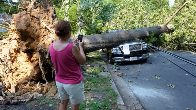
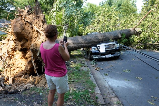
Last year in late June, a derecho blasted across Missouri, Iowa, Illinois and Indiana with 100-mph winds, leaving over 500,000 without power and flattening entire fields of corn.
Power outages can be a hidden danger of derechos as some outages in the hardest-hit areas can last for days. Extended power outages paired with building summertime heat and humidity can result in dangerously hot conditions for folks who rely on air conditioning during the hottest time of the year.
 |
A woman makes a photograph of Mike Wolfe's pick-up truck as it lies under a fallen tree in front of his house after a derecho in Falls Church, Va., Saturday, June 30, 2012. (AP Photo/Cliff Owen) |
The upcoming weather pattern during the second half of June into July will also promote a heat dome over the Southwest and an uptick in tropical downpours along the Gulf Coast.
