Multiday severe thunderstorm, tornado risk to unfold in nation's midsection beginning later this week
Following a relative lull in severe weather to end last week and start this one, Tornado Alley could roar back to life beginning later this week, as a severe weather event is expected to unfold and extend across multiple days and states, warn AccuWeather meteorologists.
"A potential multiday severe weather outbreak is possible across the central U.S. starting Thursday afternoon," said AccuWeather Senior Meteorologist Dan Pydynowski. "There could be multiple rounds of severe thunderstorms across this region and into the Midwest through next weekend."
 |
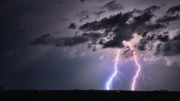
Lightning in Greenwood, Nebraska on April 15, 2024. (AccuWeather/Tony Laubach) |
The threat will reach its crescendo on Friday, reaching all the way from the southern Plains to the Midwest, but could begin as early as Thursday, and, as Pydynowski hinted at, extend into the weekend in multiple areas. Powerful winds, damaging hail, torrential downpours and even a few tornadoes can occur as thunderstorms form and roll east each day.
Following a couple of days' worth of scattered showers and mainly subsevere thunderstorm activity across the Central states on Tuesday and Wednesday, the real show looks to begin on Thursday, say AccuWeather meteorologists.
Have the app? Unlock AccuWeather Alerts™ with Premium+
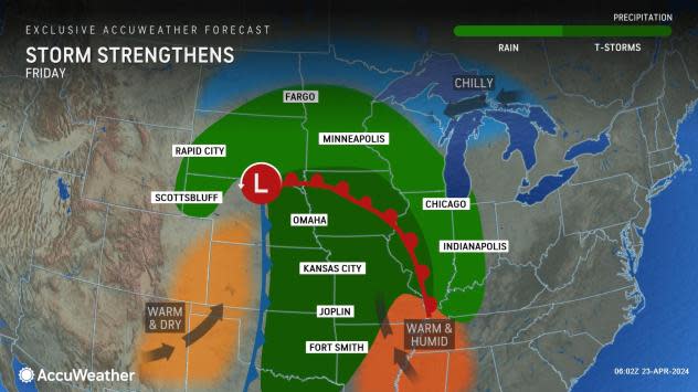
"The threat for severe weather is expected to begin later Thursday as warm, moist air from the Gulf of Mexico flows northward into the southern and central Plains," warned Pydynowski. "Meanwhile, upper-level energy in the jet stream will move out of the Rockies and Four Corners region and into the Plains."
AccuWeather meteorologists were able to identify this risk as early as last week, due to its textbook appearance. "This is a classic early spring setup for severe weather," said Pydynowski.
 |
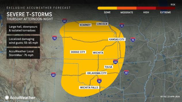
Beginning Thursday afternoon, storms are forecast to erupt from northern Texas north through Oklahoma, Kansas and far eastern Colorado, before rolling east into the night. Kansas City; Oklahoma City; and Wichita, Kansas, are among those areas at risk for this initial round of storms, some of which will pack wind gusts over 60 mph, hail up to the size of tennis balls and ferocious downpours.
While the risk of a tornado will likely be low compared to later in the week, that added danger cannot be ruled out. Since that concern will occur after dark in many areas, it is vital that residents and businesses will have a way to receive warnings, should they be issued (such as using the AccuWeather App).
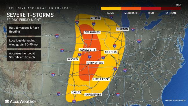
The area of low pressure helping to drive the multiday severe weather threat is forecast to reach its peak strength to end the workweek on Friday. This will help expand the risk of damaging storms and tornadoes to more states, from Texas to Illinois.
AccuWeather meteorologists have pushed the threat level of severe thunderstorms to 'moderate' on Friday. That risk could be pushed even higher as more information comes in and confidence in the overall extent and location increases.
 |
It does appear that Friday and Friday night should have the highest risk for a few tornadoes with this round of severe weather, as wind direction and speed should vary more at different heights in the atmosphere. Those in and around Des Moines, Iowa; Little Rock, Arkansas; St. Louis; and Tulsa, Oklahoma, should evaluate their plans for Friday, and be prepared to alter them should there still be a significant risk for thunderstorms that can produce tornadoes.
Dangerous lightning, hailstones, damaging winds up to the AccuWeather Local StormMax™ of 80 mph and flooding downpours can also slow travel over a much larger area that includes portions of interstates 30, 40, 44, 70, 55 and 80, as well as at area airports.
 |
The concern for severe thunderstorms in the middle of the nation will not end with the workweek. As the storm departs and another emerges across the Plains next weekend, there can be a renewal of the severe thunderstorm threat.
At first, on Saturday, the risk for severe weather will be more fragmented than on Thursday and Friday, with gusty thunderstorms possibly impacting portions of the Midwest around the Great Lakes, as the first storm departs, and the central and southern Plains, near an old frontal boundary.
 |
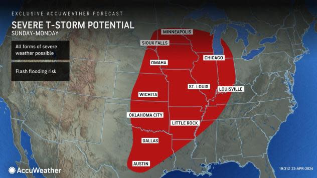
A more significant storm is expected to emerge from the Rockies around Sunday, April 28 and persist into the early part of the following workweek. It is possible, depending on how much energy and moisture is available, that the severe thunderstorm and tornado risk with this system will be even greater than with the one this week.
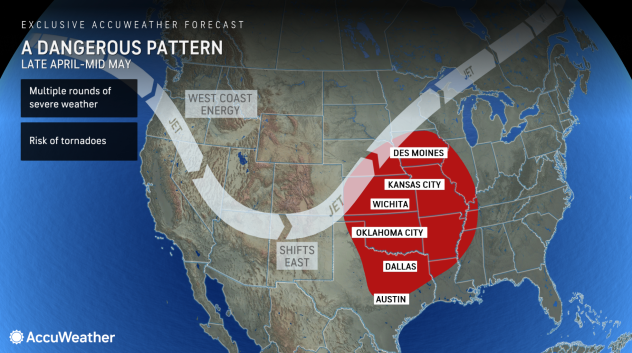
"The setup for severe weather will remain in place through next weekend, as dips in the jet stream continue to move across the western U.S. and then arrive in the Plains," said Pydynowski.
 |
Even beyond this second risk for severe weather, the pattern is expected to remain ripe for feisty storms as we change the calendar.
"[This is] a volatile time of the year, and that's going to continue right into May," said AccuWeather Long-Range Forecasting Expert Joe Lundberg.

