
Mix of snow, ice in parts of the Northeast to threaten slick travel
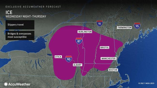
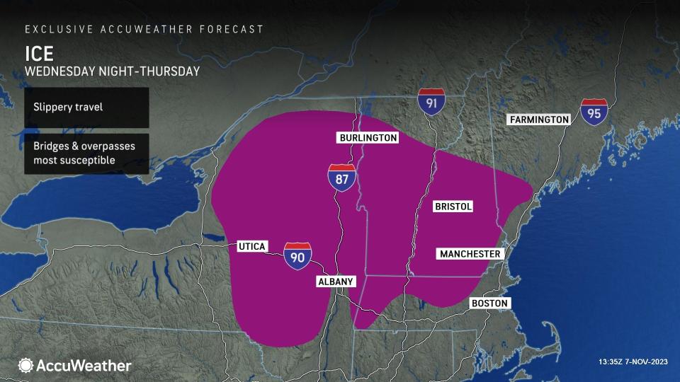

A sneaky wave of cold air will be just enough to set the stage for a snow, sleet and freezing rain event for portions of New England and upstate New York from late Wednesday to Thursday, AccuWeather meteorologists warn.
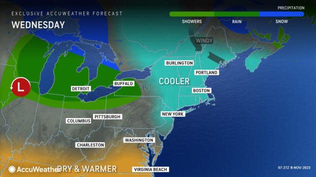
The push of cold air will follow a dose of warm autumn conditions with temperatures in the 60s and 70s F in the mid-Atlantic and southeastern New England from Tuesday.
 |
However, a preliminary storm traveling eastward along the border between Canada and the United States will send colder air southward Wednesday, AccuWeather Senior Meteorologist Adam Douty said.
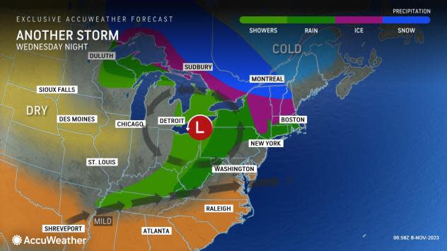
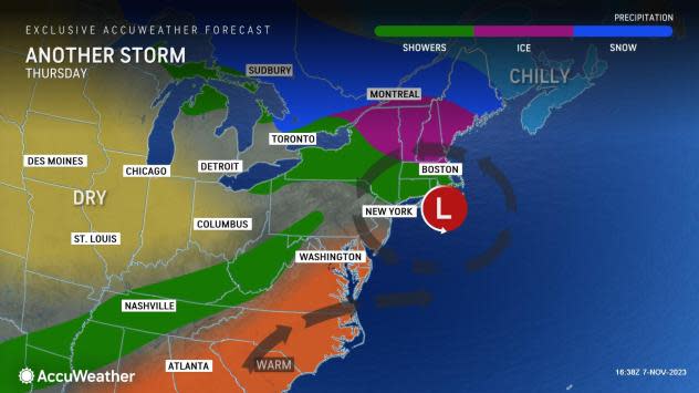
A second storm at midweek will travel a bit farther to the south and will have some fresh, colder air accompanying it. It is this storm that will pack some wintry precipitation for part of the region.
 |
"Temperatures will dip down below freezing across portions of northern New York and central and northern and western New England early Wednesday morning and may recover only a few degrees during the day before dropping off again Wednesday evening," Douty said. "This will set the stage for a mixture of snow, sleet and freezing rain to occur in these same locations from Wednesday night to Thursday morning."
Only a relatively small amount of snow and ice is expected. However, for some of the lower-elevation locations, it will be the first of the season and even a light mixture of snow and ice can make for slippery travel.
 |
Cities such as Burlington, Vermont; Manchester, New Hampshire; and Portland, Maine; are among the locations that are likely to pick up a small wintry mix from the storm later Wednesday night to Thursday. A bit of ice may make some surfaces slippery in places like Worcester, Massachusetts. Motorists may want to allow some extra time for the Thursday morning commute around Boston, especially over the northern and western suburbs, where a wintry mix may start the day.
"The most likely locations where a small buildup of ice may occur on trees, power lines and some roads will be over the higher elevations in places such as the Adirondacks, parts of the Berkshires and the Green and White Mountains of Vermont and New Hampshire," AccuWeather Senior Meteorologist Brett Anderson said.
 |
A few inches (several centimeters) of snow may fall in the northern tier of Vermont, New Hampshire, New York, northwestern Maine and parts of central Ontario and southern Quebec.
Farther to the south, including in New York City and Philadelphia, the air will be a bit too warm to allow for any ice or snow. However, even in these areas and many others, the showers and other conditions will make for AccuWeather RealFeel® Temperatures in the 30s at times.
A sneaky storm from the southern Plains and the lower Mississippi Valley may bring a period of rain to portions of Virginia, Maryland, Delaware and southern New Jersey on Friday before dry and cool conditions expand during the weekend.
Want next-level safety, ad-free? Unlock advanced, hyperlocal severe weather alerts when you subscribe to Premium+ on the AccuWeather app. AccuWeather Alerts™ are prompted by our expert meteorologists who monitor and analyze dangerous weather risks 24/7 to keep you and your family safer.
