
Flooding forces evacuation order, state of local emergency in Pemberton
The Village of Pemberton has declared a state of local emergency because of flooding.
An evacuation order has been issued for six properties along Airport Road, which include some residential properties, a golf course and adventure tourism companies connected to the airport.
Evacuation alerts are also in place for about 20 other properties in the Pemberton Valley, as several waterways swell with melting snow.
The village says properties at risk include those along the Lillooet, Ryan, Miller, Green and Birkenhead rivers, Pemberton Creek and Lillooet Lake.
In its emergency declaration, dated Tuesday at 12 p.m. PT, the village says there is "an immediate danger to life safety caused by flooding in the Pemberton Valley" for the affected properties.
People in the area have been told to evacuate toward the Sea to Sky Highway.
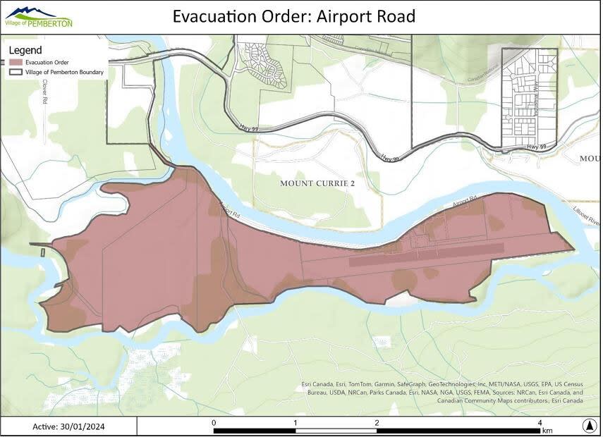
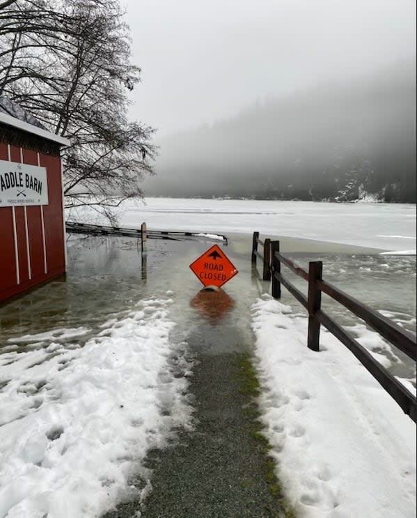
An evacuation order in Pemberton applies to six properties, including a golf course, residential homes and airport properties. (Village of Pemberton)
Pemberton is located about 30 kilometres north of Whistler and 150 kilometres north of Vancouver. It is home to about 3,400 people.
On Tuesday morning, B.C.'s River Forecast Centre expanded a flood warning to include the Lillooet River, saying flows at a gauge near Pemberton were at levels seen once every five to 10 years.
A flood warning remains in effect for the Squamish River, where a bulletin says flows have exceeded once-in-five-year levels at a gauge near Brackendale, north of downtown Squamish.
The risk of flooding is expected to persist into Thursday, as another atmospheric river brings more rain and melting snow, the bulletin says.
Anyone affected by the evacuation order who requires transportation from the area is advised to call 604-894-6135. Emergency support services are available through the Red Cross at 1-888-800-6493.
Intersection flooded
Pemberton resident Dusty Mckinnon says the intersection of Pemberton Portage Road and Vine Road is flooded.
He says it may be difficult for those living in townhouses on the southeast side of Pemberton Portage Road — a stretch of Highway 99 that runs through the village — to leave their community.
"You can't get through there unless you're willing to take a risk with your big vehicle," said Mckinnon, adding water was up to the hood of his vehicle when he drove through on Tuesday.
Riel Cairns owns BackCountry Pizza, located near the flooded intersection at Pemberton Portage and Vine roads.
He said he has heard from customers about how they are preparing.
"We had people with livestock who had to get their livestock out of their properties ... various different residences that are sandbagging as we speak," said Cairns.
Cairns says she has seen floods in Pemberton, but usually not at this time of year.
"This is Pemberton, if it's not smoke and fires in the summertime, then invariably we'll get some floods at some point," said Cairns.

