El Niño and melting snow causing warmer Alberta temperatures

If it has felt unseasonably warm for Edmonton in January, that's because it has been. An El Niño year combined with melting snow have contributed to the warmer weather.
Edmonton set a record Tuesday with a high of 12 C at 3 p.m., said Alysa Pederson, a warning preparedness meteorologist with Environment and Climate Change Canada.
Only weeks ago overnight lows were in the –30s.
"It's quite the roller-coaster, but this kind of thing can happen in Alberta. Especially when we're in a strong El Niño year, we can see fluctuations that are pretty strong like this," Pederson said.
"Even if we just look at last year, we were very warm through … January and February in 2023, and then of course we hit a deep freeze there at the end of [February]."
This time of year, Edmonton typically sees an average high of –6 C, but temperatures climbed to 10 C on Sunday, a huge jump from the –37.7 C the city experienced two weeks earlier.
Pederson says there have been record highs set across the province, noting that 33 daytime high records were broken just in the last couple of days.
In Calgary, the average highs for January usually sit around – 3 C, but on Sunday the high was 13.1 C.
The biggest jump in temperature from the cold snap to now was noted at a weather station just north of High Level.
"A station in Keg River … on Jan. 29, they had a high of 14.4 C," said Pederson. "That's 65 degrees warmer than the morning low that they had of –50.6 C in the cold snap a couple of weeks ago — it's a pretty significant change."
Pederson says the warmer temperatures have been observed across the Prairies, including Saskatchewan and Manitoba.
Melting snow causes warmer temperatures
By midday on Tuesday, Edmonton had already reached 11.5 C, which broke previous record highs.
"The last time we were above 11.5 C in January would have been Jan. 28, 1941," said Pederson.
She noted that there have been other times Edmonton saw January temperatures creep nearly that high. Edmonton reached 11.1 C three times previously — on Jan. 23, 1968, on Jan. 31, 1976, and on Jan. 4, 2012.
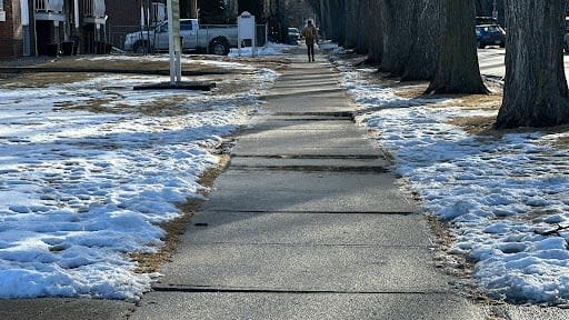
Pederson said Tuesday's temperatures were able to creep that high,because there is less snow coverage on the ground than there was Monday.
In what's known as the albedo effect, snow coverage prevents temperatures from getting as high as they could.
"When we have a lot of [snow], more of the energy from the sun gets reflected back and it doesn't actually absorb into the ground, absorb into things," said Pederson.
"When we have snow cover it's harder to get to these really, really high temperatures."
Pederson said Edmonton had a lot of cloud coverage on Monday, further preventing temperatures from creeping up any higher, and overnight temperatures set up Tuesday to be much warmer.
"When you have temperatures like we did [Monday] night where our temperatures didn't really go below 6 C, your snow is melting … which is part of the reason that we actually hit a higher temperature today than we did yesterday," Pederson said.
When will winter return?
Temperatures in Alberta are expected to return to normal by this weekend, but Pederson says that overall, this winter will be warmer than normal.
"Our winter season in an El Niño year is forecast to be above normal for the season," she said.
February temperatures will be above normal but it will cool down over the next couple of days, she said.
It could get down to –5 C this weekend, and stay there next week.
"But there's no signal in the next couple of weeks of any big cold snaps … so kind of that normal, wintry, just-below-zero temperatures is kind of what we're looking at for the next little bit."

