
Budding tropical disturbance to drench part of Caribbean


While the chance of tropical depression or storm formation is slim over the next week or so in the Atlantic basin, the chance is not zero and the brewing disturbance will produce an area of drenching rain and gusty thunderstorms over a portion of the Caribbean for a time during the first week of June.
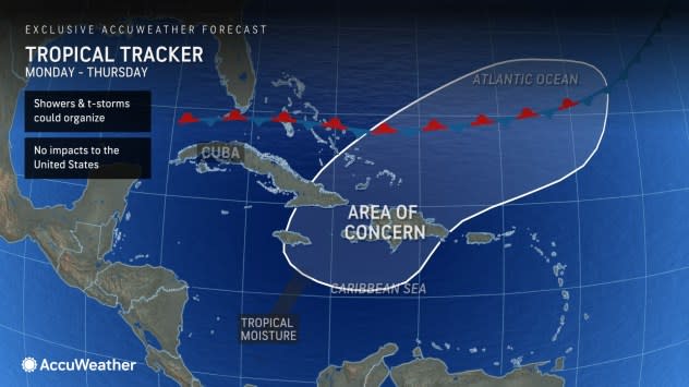
AccuWeather meteorologists pointed out last week, and AccuWeather's Long-Range Team even earlier in May, that the area extends from the north-central Caribbean to part of the southwestern Atlantic east of the Bahamas and north of Puerto Rico.
The zone extends across an area with a weak tropical disturbance, combined with approaching energy from the Gulf of Mexico and proximity to an old front that has stalled in the region.
 |
"While waters are warm enough in the region to support tropical development, along with these other positive factors, wind shear may be a deterrent for development," AccuWeather Lead Tropical Meteorologist Alex DaSilva said.
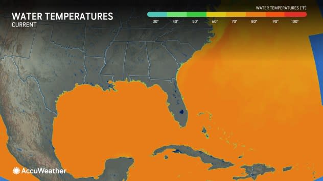
Water temperatures over much of the zone that AccuWeather has outlined are at or above 80 F and, in some cases, are running well above the historical average for early June. The minimum threshold for tropical development is 80 F.
 |
Wind shear is associated with breezes that are often found in the tropics. When these breezes blow strongly in one direction or change directions at different heights above the sea surface, development may not occur, or an established tropical system could weaken.
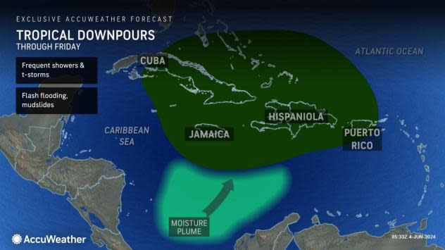
Regardless of any tropical development, this area of disturbed weather will result in an uptick in showers and thunderstorms through the end of this week from Jamaica to Haiti and the Dominican Republic, the Turks and Caicos, eastern Cuba and the southeastern Bahamas. It is possible that portions of Puerto Rico are also affected by downpours and locally gusty thunderstorms through Thursday.
 |
Several inches of rain may pour down in a few hours, especially where mountainous terrain enhances rainfall. Where downpours persist, the risk of dangerous flash flooding will increase bringing the potential for mudslides. Seas and surf may get choppy in the vicinity of gusty thunderstorm activity.
"Because the system is likely to get scooped up by brisk steering winds, it should accelerate off to the northeast and away from the islands later this week," DaSilva said. "There will be no impact from this system on the United States mainland."
Largely because of abnormally warm ocean surface water and deep warm water, the zone from the western Caribbean to the Gulf of Mexico to the southwestern Atlantic, including along the southern Atlantic coast of the U.S., will remain an area to watch in the coming weeks. Many of these are considered "home brew" systems because of their proximity to North and Central America.
 |
DaSilva and AccuWeather's staff of dozens of meteorologists are anticipating a super-charged hurricane season for 2024 and have been warning of the risks since late winter.
Want next-level safety, ad-free? Unlock advanced, hyperlocal severe weather alerts when you subscribe to Premium+ on the AccuWeather app. AccuWeather Alerts™ are prompted by our expert meteorologists who monitor and analyze dangerous weather risks 24/7 to keep you and your family safer.
